The Lone Numbers

pokemainiac

New member
Here is the official map of the Lone Islands which I scanned this morning from my VODT book.

LoneIslandsMap.jpg


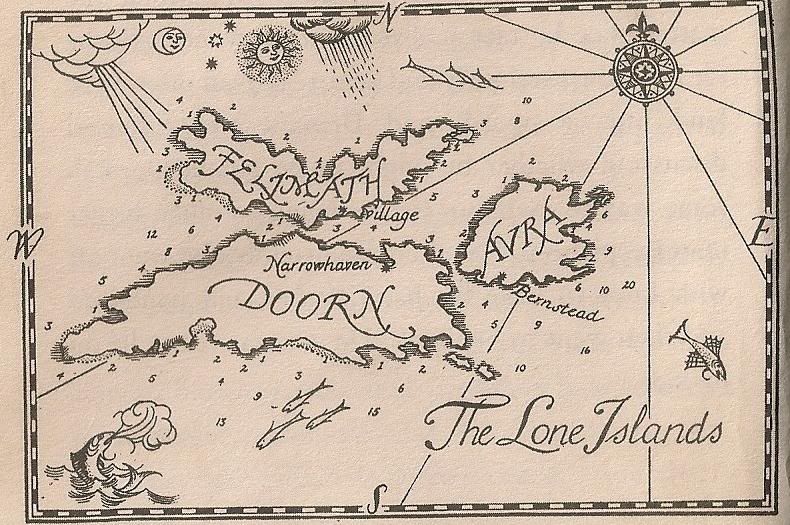
What I'm not sure about are the numbers around the islands. Could anyone tell me what they could be for?
 
I do believe that in imitation of a serious real world nautical chart, those are soundings, probably in fathoms. Depending on how much water your vessel draws, you'd be insane to chart your approach through one of the shallower channels whereas a fishing scow could go practically anywhere.

You know, I think I may have a little fun with that map. Wouldn't it be great to do a Google Earth style satellite map of the Lone Islands? Don't doubt it, I can do that sort of thing. :D
 
Last edited:
You know, I think I may have a little fun with that map. Wouldn't it be great to do a Google Earth style satellite map of the Lone Islands? Don't doubt it, I can do that sort of thing. :D

I take it you've been to the Lone Islands then? Because you'd probably need to know where everything is.
 
I do believe that in imitation of a serious real world nautical chart, those are soundings, probably in fathoms. Depending on how much water your vessel draws, you'd be insane to chart your approach through one of the shallower channels whereas a fishing scow could go practically anywhere.

You know, I think I may have a little fun with that map. Wouldn't it be great to do a Google Earth style satellite map of the Lone Islands? Don't doubt it, I can do that sort of thing. :D
well, I'd like to see that when it's done!!!

I take it you've been to the Lone Islands then? Because you'd probably need to know where everything is.

Badgers turn up in the most unexpected places. You never know.
 
Back
Top